Decimal to DMS: Formatting Coordinates for Property Deeds and Topographic Maps
A decimal to DMS converter turns coordinates like 38.8977° into 38°53′51.72″N — the format that still appears on every recorded property deed, county plat book, and USGS topographic quad in the United States. If you've pulled a parcel centroid from a GIS layer and need to drop it into a legal description, or you're plotting a boundary corner onto a printed topo map, this is the conversion you'll reach for. The math is three lines of arithmetic, but the context — why surveyors, title companies, and cartographers still demand DMS — fills an entire profession.
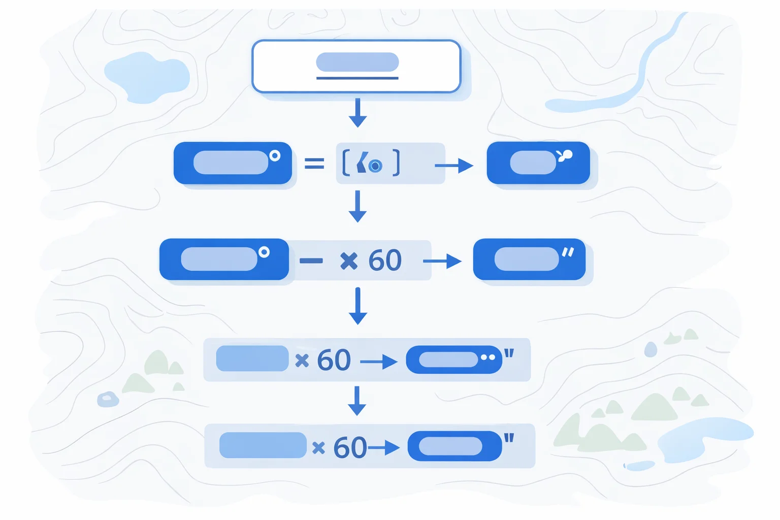
The Floor-Multiply-60 Formula
Strip the sign first — it becomes a compass direction letter later. Then peel off each layer:
Degrees = floor(|DD|)
Minutes = floor((|DD| − Degrees) × 60)
Seconds = ((|DD| − Degrees) × 60 − Minutes) × 60
The integer part is degrees. Multiply the leftover fraction by 60 to get minutes (take the integer again), then multiply that leftover by 60 for seconds. The total scale factor from degrees to seconds is 3,600 — same reason there are 3,600 seconds in an hour. Once you have the three numbers, attach N or S for latitude (positive = North) and E or W for longitude (positive = East). The negative sign never appears in DMS notation itself.
If you need the reverse operation — starting from DMS on a deed and converting to decimal for a GIS import — our DMS to decimal degrees converter handles that workflow.
Why Legal Documents Still Require DMS
Every database and web mapping API stores coordinates as decimal floating-point numbers. So why does the county recorder's office still insist on degrees, minutes, and seconds?
The short answer: legal inertia backed by practical reasons. Land records in the U.S. trace back to the General Land Office surveys of the early 1800s. Surveyors in the field read angles off a transit or theodolite — instruments graduated in degrees, minutes, and seconds. Those readings were transcribed directly into field notes, which became the legal description attached to patents and deeds. Centuries of case law, title chain documentation, and court rulings reference DMS bearings. Switching to decimal would require rewriting millions of existing legal descriptions and retraining every title examiner, abstractor, and real estate attorney in the country.
There's a practical advantage too. DMS is self-segmenting: when you read "38°53′52″N, 77°02′12″W" aloud in a courtroom or over a two-way radio, each component is distinct. Decimal notation — "38.8978, negative 77.0367" — invites transcription errors, especially when dictated verbally. For documents that may be read aloud during depositions or boundary hearings, DMS remains the safer format.
The US Public Land Survey System and Township Coordinates
The Public Land Survey System (PLSS) divides most U.S. land west of the Appalachians into a grid of townships (6×6 mile squares), ranges, and sections. Each township corner and section corner has a geographic coordinate in DMS, tied to the National Spatial Reference System maintained by the National Geodetic Survey.
A typical PLSS legal description reads: "The NW 1/4 of Section 14, Township 2 North, Range 5 East, Principal Meridian." That looks like it avoids coordinates entirely, but the underlying monument — the physical corner marker — has DMS coordinates in the Bureau of Land Management's survey records. When a boundary dispute lands in court, surveyors convert between the PLSS description and DMS coordinates to locate the exact point on the ground. If your GIS data stores the corner as 40.689200°N, −74.044500°W, you'll need to convert that to 40°41′21.12″N, 74°02′40.20″W before it appears in any filing.
Converting Decimal Coordinates for a Land Title
When a surveyor or GIS analyst prepares a legal description for a deed, the decimal-to-DMS conversion has to follow a few rules beyond the basic formula:
- Specify the datum.Modern U.S. filings use NAD 83 (North American Datum of 1983). Older deeds may reference NAD 27. The difference between the two can be 10–80 meters depending on location — enough to shift a property corner into the neighbor's yard.
- Round to the required precision.Most county recorders accept whole seconds or tenths of a second. Don't submit 38°53′51.7194652″N — that implies sub-millimeter accuracy your survey instrument can't deliver.
- Use the hemisphere letter, not a sign.Write "77°02′12″W", never "−77°02′12″". Legal descriptions always use N/S/E/W.
- Match the format of adjacent descriptions.If the parent parcel's deed uses the degree symbol with prime marks (38°53′52″N), don't switch to the letter abbreviation (38d 53m 52s N). Consistency prevents confusion during title searches.
A title company will bounce a deed that mixes datums, uses ambiguous notation, or lists coordinates that don't match the plat map. Getting the DMS conversion right is table stakes.
Worked Examples: Real Property Corners and Landmarks
Example 1 — U.S. Capitol Building (38.8899°N, −77.0091°W):
- Latitude: floor(38.8899) = 38°. Remainder: 0.8899 × 60 = 53.394. Minutes: 53. Remainder: 0.394 × 60 = 23.64″. Result: 38°53′23.64″N
- Longitude: floor(77.0091) = 77°. Remainder: 0.0091 × 60 = 0.546. Minutes: 0. Remainder: 0.546 × 60 = 32.76″. Result: 77°00′32.76″W
This is the kind of coordinate you'd find in a federal land record managed by the General Services Administration. The zero minutes in the longitude are written as "00" — never omitted.
Example 2 — Denver County Courthouse (39.7392°N, −104.9903°W):
- Latitude: floor(39.7392) = 39°. 0.7392 × 60 = 44.352. Minutes: 44. 0.352 × 60 = 21.12″. Result: 39°44′21.12″N
- Longitude: floor(104.9903) = 104°. 0.9903 × 60 = 59.418. Minutes: 59. 0.418 × 60 = 25.08″. Result: 104°59′25.08″W
Notice the longitude minutes are 59 — one more and it would roll over to 105°00′. This is the DMS equivalent of a clock at 11:59. If your seconds calculation had returned 60.00, you'd need to carry: bump minutes to 60, which then bumps degrees to 105 with 0 minutes and 0 seconds.
Example 3 — BLM Survey Monument, NM (34.5200°N, −106.3750°W):
- Latitude: floor(34.5200) = 34°. 0.52 × 60 = 31.2. Minutes: 31. 0.2 × 60 = 12.00″. Result: 34°31′12.00″N
- Longitude: floor(106.3750) = 106°. 0.375 × 60 = 22.5. Minutes: 22. 0.5 × 60 = 30.00″. Result: 106°22′30.00″W
Clean numbers like these often indicate a section corner or quarter corner in the PLSS grid. The 0.5 × 60 = 30 minutes pattern is a quick mental-math check: half a minute is 30 seconds, half a degree is 30 minutes.
Reading and Writing DMS on Printed Topographic Maps
USGS 7.5-minute quadrangle maps — the standard topographic series covering the continental U.S. — are defined by their corner coordinates in DMS. A quad labeled "Washington West" might span from 38°52′30″N to 38°00′00″N latitude, covering exactly 7.5 arc-minutes of latitude and 7.5 arc-minutes of longitude.
Along the map border, tick marks appear at 2.5-minute intervals. Interior grid crosses (small plus signs printed on the map face) mark the intersection of latitude and longitude lines. To plot a converted DMS coordinate onto the map, count tick marks from the nearest corner, interpolate between grid lines, and mark the spot. At mid-latitudes, each 2.5-minute interval spans roughly 4.6 km (2.9 miles) north–south and about 3.6 km (2.2 miles) east–west.
The USGS National Geospatial Program publishes both the classic printed quads and the newer US Topo digital series. Even the digital versions label corner coordinates in DMS, preserving backward compatibility with decades of field practice.
For surveyors correlating field data with map sheets, the workflow is: export the decimal coordinate from the RTK receiver, convert to DMS using the floor-multiply-60 formula, then plot on the appropriate quad. If the surveyor also needs to express angles in gradians for European-standard instruments, that's a separate conversion on the bearing angle, not on the geographic coordinate.
How Many Decimal Seconds Matter in a Legal Description?
Precision isn't about showing off your instrument's capabilities. It's about matching the actual accuracy of the survey and the recording standards of the jurisdiction.
| DMS Precision | Ground Distance (40°N lat) | Typical Use |
|---|---|---|
| Whole seconds (38°53′52″) | ~24 m (78 ft) | Rural parcels, section corners |
| 0.1″ (38°53′51.7″) | ~2.4 m (7.8 ft) | Subdivision plats, urban lots |
| 0.01″ (38°53′51.72″) | ~0.24 m (0.8 ft) | Boundary disputes, easements |
| 0.001″ (38°53′51.719″) | ~0.024 m (0.9 in) | Geodetic control monuments |
A rural 40-acre parcel might use whole-second precision in its deed because the corner monuments are iron pins set decades ago with compass-and-chain accuracy. An urban subdivision plat where lot lines are 50 feet apart needs at least 0.1″ to distinguish one corner from the next. Recording more precision than your survey instrument actually achieved is misleading — and a sharp opposing attorney in a boundary dispute will call it out.
When converting from decimal degrees, the number of decimal places in your input determines the maximum meaningful precision in DMS. Four decimal places in DD (≈11 m) correspond roughly to whole-second DMS. Six decimal places (≈0.11 m) justify 0.01″ seconds. Don't round a 4-decimal-place input to 0.001″ seconds — you'd be manufacturing false precision.
DMS Formatting Conventions: Symbols, Letters, and Compact Notation
There's no single "correct" way to write DMS. Different industries and agencies have settled on different conventions:
- Symbol notation:38°53′52″N — uses the degree symbol (°), prime (′), and double prime (″). This is the format on USGS topo maps and in most surveying textbooks.
- Letter abbreviation:38d 53m 52s N — avoids special characters. Used in plain-text databases and older software that can't render Unicode symbols.
- Compact numeric:385352N 0770212W — no separators, fixed-width fields (DDMMSS for latitude, DDDMMSS for longitude). This format appears in aeronautical databases and some BLM data files.
- ISO 6709:+385352.00-0770212.00/ — uses signs instead of hemisphere letters and ends with a slash. Rarely seen in property law but common in international data exchange.
For deed filings, match whatever the existing deed chain uses. If the parent parcel's description writes "N 38° 53′ 52″" with the direction letter first, follow that pattern. Consistency in the title chain matters more than following a universal standard. If you're working with angle measurements in a different unit system entirely, our radians to degrees converter can help translate between mathematical and geographic conventions.
One practical tip: when pasting DMS into a word processor for a legal document, use Unicode characters (U+00B0 for °, U+2032 for ′, U+2033 for ″) rather than keyboard approximations like the letter "o" or straight quotes. Title searchers decades from now will be parsing these documents, and garbled symbols create ambiguity that can stall a property transfer.